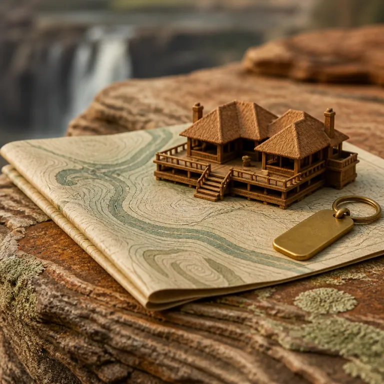
Reading the Victoria waterfalls map for a luxury focused trip
A well designed Victoria Falls map is the quiet secret behind a seamless luxury stay. When you understand how the Zambezi River curves toward the edge and where each section of the falls sits, you can match five star hotels to the views and experiences you value most. This is where discerning travellers turn cartography into comfort, using every contour line on a detailed falls map to decide which side of the border, which town, and which gorge outlook will frame their suite windows.
On any detailed map of Victoria Falls, you will see how the river narrows before plunging into the Batoka Gorge, and how the main falls stretch for more than 1 700 metres along the cliff. That same cartographic view also shows the relationship between the Zimbabwe side and the Zambian side, the position of the historic falls bridge, and the layout of the surrounding national parks that protect this natural wonder. With this spatial context, a Zimbabwean luxury lodge or a premium hotel in Livingstone stops being an isolated choice and becomes part of a curated route through southern Africa.
For guests booking high end suites, the site plan is not only about the water itself. It reveals how close a property lies to the entrance of the national park, how far you must walk to reach the viewpoints over the main falls, and whether your terrace will face the spray that locals call the smoke that thunders. It also clarifies transfer times from Victoria Falls town to the airport, or from the Zambian side to private river islands on the Zambezi River, which matters when you are coordinating helicopter flights, guided tours, and fine dining reservations.
Choosing between Zimbabwe and Zambia using the falls map
Luxury travellers often ask whether the Zimbabwe side or the Zambian side offers the better stay, and the most honest answer begins with a Victoria waterfalls map. On the Zimbabwe Victoria stretch of the gorge, the map shows a continuous chain of viewpoints inside the national park, which translates into more angles on the main falls from a single, well located hotel. Across the border, the Zambian side map highlights proximity to Livingstone Island and the famous Devil’s Pool, which appeals to guests who want exclusive access to dramatic water level experiences.
When you overlay five star properties onto this map of Victoria Falls, patterns emerge that help you decide. The Victoria Falls Hotel, for example, sits about a 10 to 15 minute walk from the entrance to Victoria Falls National Park, and its lawns look toward the falls bridge and the mist rising from the gorge. The Royal Livingstone Hotel by Anantara, on the Zambian bank of the Zambezi River, lies within walking distance of the park gate and offers direct access to riverside paths. For a deeper look at how this landmark still shapes high end stays, read this analysis of colonial heritage at Victoria Falls, then compare its location on your own map to newer riverside lodges.
On the Zambian side, a careful reading of the Victoria waterfalls map reveals which luxury lodges sit directly on the Zambezi River above the falls and which are tucked deeper into the bush. Properties closer to the river channel offer effortless access to sunset cruises, while those set back in the national park area trade immediate water views for quieter wildlife encounters. Either way, the cartography clarifies how long it takes to reach Livingstone town, how close you are to Mosi oa Tunya National Park, and how easily you can cross between Zimbabwe and Zambia for dinner or spa appointments.
Heritage, national parks, and where to stay around the gorge
Victoria Falls is not only a wall of water; it is a UNESCO listed heritage landscape framed by national parks on both sides of the Zambezi River. A precise Victoria Falls map helps you see how these protected areas wrap around the gorge and how luxury properties either sit inside the park boundaries or just outside them. That distinction matters for guests who want to balance heritage immersion, wildlife viewing, and the refined service of a premium hotel.
On the Zimbabwean side, Victoria Falls National Park and the adjacent Zambezi National Park protect riverine forest, open savanna, and the cliffs of the Batoka Gorge, and the map shows how game drive routes loop behind the main falls. High end lodges that border these national parks can offer sunrise drives followed by late morning spa treatments, while still keeping you close enough to hear the distant roar of the falls Zimbabwe is famous for. Across the river, Mosi oa Tunya National Park in Zambia combines river frontage with relics of colonial history in Livingstone town, and the map reveals how easily you can move between heritage sites and riverside suites.
For travellers building a broader heritage themed itinerary, the Victoria waterfalls map becomes one layer in a wider cultural atlas of Zimbabwe. Many guests pair a stay at the falls with archaeological journeys from Great Zimbabwe to Matobo, and this archaeological route guide shows how those sites complement the natural drama of the gorge. When you plot these destinations together, you see how the river, the national parks, and the stone ruins form a coherent narrative of southern Africa, and you can choose luxury hotels that echo that sense of place rather than feeling detached from it.
Seasonality, water levels, and timing your luxury stay
Timing is everything at Victoria Falls, and a good Victoria waterfalls map becomes even more valuable when you overlay it with seasonal water data. The Zambezi River changes character through the year, and that shift affects which viewpoints, which side of the border, and which activities will best suit a premium itinerary. Official guidance notes that “April to June offers optimal water flow and visibility.”
During the high water months, the main falls thunder into the Batoka Gorge with such force that spray can obscure some viewpoints on the Zimbabwe side, while the smoke that thunders rises hundreds of metres into the air. On your map, you can mark which paths in the national park are likely to be drenched and which luxury hotels provide easy access to drier vantage points along the edge. In contrast, the dry season from roughly late August to late November reveals the rock face and channels of the gorge, and the Victoria Falls map shows how pools form along the lip near Livingstone Island on the Zambian side.
That is when exclusive experiences such as carefully guided swims near Devil’s Pool become possible, and the map helps you judge how close your Zambian side lodge should be to the access points. Guests who prefer a fuller curtain of water often choose shoulder months, using the falls map to balance spray intensity on the falls Zimbabwe side with clearer views from Zambia. Whether you arrive in the heart of the dry season or just after the rains, aligning your travel dates, your chosen town, and your preferred hotel with the hydrology of the Zambezi River is the hallmark of a well planned luxury escape.
From cape town to Victoria Falls town: mapping premium routes
Many high end travellers approach Victoria Falls as part of a longer southern Africa journey, often starting in Cape Town and then flying north. A Victoria waterfalls map helps you visualise how that shift from ocean to river, from Table Mountain to the gorge, will feel across your itinerary. It also clarifies how to sequence nights between Victoria Falls town, the Zambian town of Livingstone, and more remote river lodges upstream.
On the Zimbabwean side, Victoria Falls town sits just south of the gorge and functions as a compact hub for tourism, with luxury hotels, fine dining, and helicopter operators clustered within a few kilometres of the national park gate. When you plot your hotel on the map, you can see whether you will walk to the viewpoints over the main falls or rely on private transfers, which influences how spontaneous your days can be. For travellers who enjoy combining urban refinement with wilderness, routing via Bulawayo and its historic avenues can be rewarding, and this guide to refined urban escapes in Bulawayo town shows how Zimbabwe’s second city complements a stay on the Zambezi River.
On the Zambian side, the map reveals how Livingstone town lies slightly further from the edge of the falls but closer to some upstream islands and river based lodges. This layout suits guests who want quieter nights on the water and are happy to transfer into the park for daytime viewing. When you trace the line of the Zambezi River from Zambia to Zimbabwe and onward toward Botswana and Namibia, the Victoria Falls map becomes a planning tool for multi country safaris, helping you align flight schedules, border crossings, and the sequence of national parks you wish to visit.
Cross border perspectives and eco conscious luxury around the falls
One of the great privileges of staying in luxury accommodation around Victoria Falls is the ease with which you can experience both Zimbabwe and Zambia in a single trip. A detailed Victoria waterfalls map shows the exact position of the falls bridge, the border posts, and the walking routes that link the two sides, which is crucial when planning cross border dinners or spa visits. It also highlights how the shared management of the gorge and surrounding national parks supports eco friendly tourism practices.
Local tourism boards and national parks authorities on both sides of the Zambezi River have invested in guided tours and aerial flights that minimise environmental impact while maximising understanding of this natural wonder. Operators rely on accurate maps and GPS devices to keep visitors on designated paths inside the park area, protecting fragile vegetation along the gorge and near the water’s edge. As a guest in a premium hotel, you can ask how your chosen property collaborates with these partners, whether through conservation levies, community projects with Zimbabwean and Zambian staff, or support for Lozi people who first named the falls Mosi oa Tunya, the smoke that thunders.
From a practical perspective, the Victoria Falls map also helps you identify quieter viewpoints and less crowded times of day, which is especially valuable in peak tourism seasons. Some luxury lodges arrange early access walks or private guides who know how to navigate both the Zimbabwe Zambia border formalities and the best angles on the falls Victoria panorama. When you see how the river, the towns, the gorge, and the national parks interlock on the map, it becomes clear that thoughtful, eco conscious planning is not an optional extra but an integral part of a refined stay in this corner of southern Africa.
Key figures that shape a Victoria waterfalls map
- Victoria Falls spans about 1 708 metres in width and 108 metres in height, making it one of the largest continuous curtains of water on earth according to data compiled from Wikipedia and figures cited by the Zambia Tourism Agency and UNESCO World Heritage documentation.
- Visitor numbers reach around 1 000 000 people per year, based on figures reported by TourRadar and estimates referenced by the Zimbabwe Tourism Authority and regional tourism statistics, which explains why a precise Victoria waterfalls map is essential for finding quieter viewpoints and planning premium experiences.
- The falls sit roughly midway along the border between Zimbabwe and Zambia in southern Africa, and their protected status as a UNESCO World Heritage Site since 1989 underpins strict national park zoning on both sides.
- Guidance from local experts suggests that April to June offers optimal water flow and visibility, which aligns with hydrological data from Zambezi River monitoring programmes showing strong but not yet overwhelming discharge into the Batoka Gorge.
FAQ about Victoria Falls maps and luxury stays
How does a Victoria waterfalls map help me choose my hotel
A detailed Victoria waterfalls map shows the exact position of your hotel relative to the main falls, the national park entrances, and the Zambezi River, which helps you judge walking distances and transfer times. By comparing properties on both the Zimbabwean and Zambian sides, you can decide whether you prefer immediate access to viewpoints, quieter riverfront seclusion, or proximity to town amenities. This spatial understanding lets you align your budget and expectations with the level of convenience and privacy you want.
Which side of Victoria Falls is better for luxury travellers
The Zimbabwe side generally offers more continuous viewpoints of the main falls within Victoria Falls National Park, which suits guests who prioritise varied perspectives and easy access from their hotel. The Zambian side, centred on Livingstone and Mosi oa Tunya National Park, excels for river based activities, seasonal access to Devil’s Pool, and intimate lodges along the Zambezi River. A good map helps you see these differences clearly so you can choose the side, or combination of sides, that best matches your style.
What is the best time of year to visit Victoria Falls
Hydrology and tourism data indicate that the months from April to June usually offer a balance of strong water flow and good visibility, with lush surroundings and dramatic spray. Earlier in the year, the Zambezi River can be so full that mist obscures some viewpoints, while the late dry season around late November can leave sections of the gorge more exposed and the falls less voluminous. Your ideal timing depends on whether you prefer maximum water power, clearer rock formations, or access to specific activities such as Devil’s Pool on the Zambian side.
Are there activities beyond viewing the falls from the map viewpoints
Yes, the wider Victoria Falls area supports a broad range of activities that appear on most detailed maps, including helicopter flights, river cruises, and guided walks through the national parks. Adventure seekers can arrange white water rafting in the Batoka Gorge or bungee jumping from the falls bridge, while those seeking calmer experiences may opt for spa treatments, fine dining, and sunset cruises. The map helps you understand where each activity starts and how far it lies from your chosen hotel.
Do I need a guide to explore Victoria Falls using a map
Independent travellers can navigate the main paths using a clear Victoria waterfalls map, as trails on both the Zimbabwe and Zambia sides are well marked inside the parks. However, hiring a qualified guide adds context about geology, local culture, and wildlife, and can help you time your visit to avoid crowds or harsh midday light. Many luxury hotels include guided tours in their rates, turning the map from a simple navigation tool into a framework for deeper interpretation of this natural wonder.